See The Nature
In Your Supply Chain
Map biodiversity across your farms from satellite, turning land into data you can act on. Reward farmers, build resilience, and meet the EU's 10% target by 2030.
Biodiversity Results

“At Carbery, we wanted to better understand the biodiversity resource that exists across our supplier base and establish a meaningful baseline for the future.”
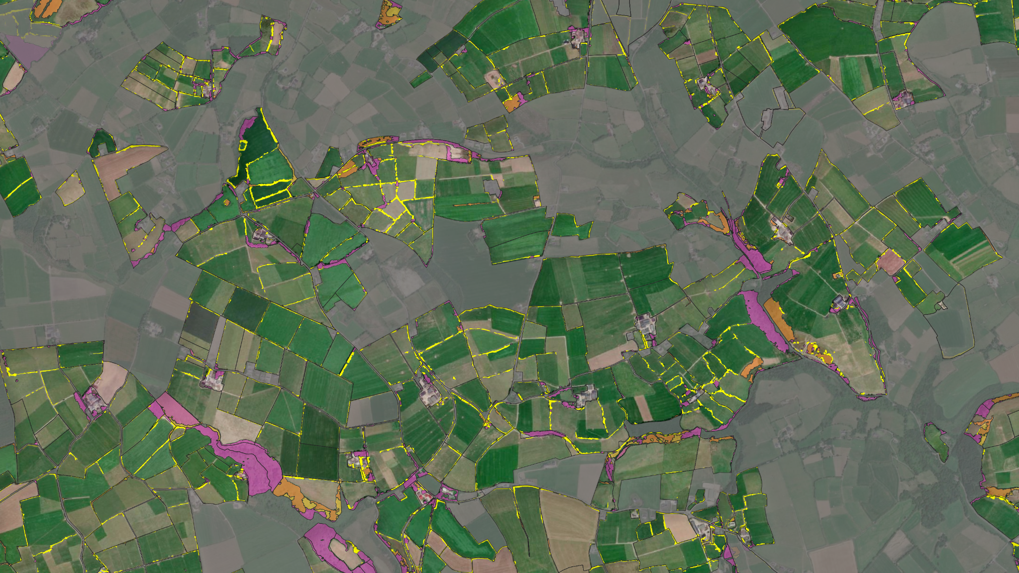
We Mapped 90% of Carbery's Supplier Base
Carbery's first complete biodiversity baseline. We classified every supplier farm from satellite, turning scattered land into one clear, comparable picture of the region's nature.
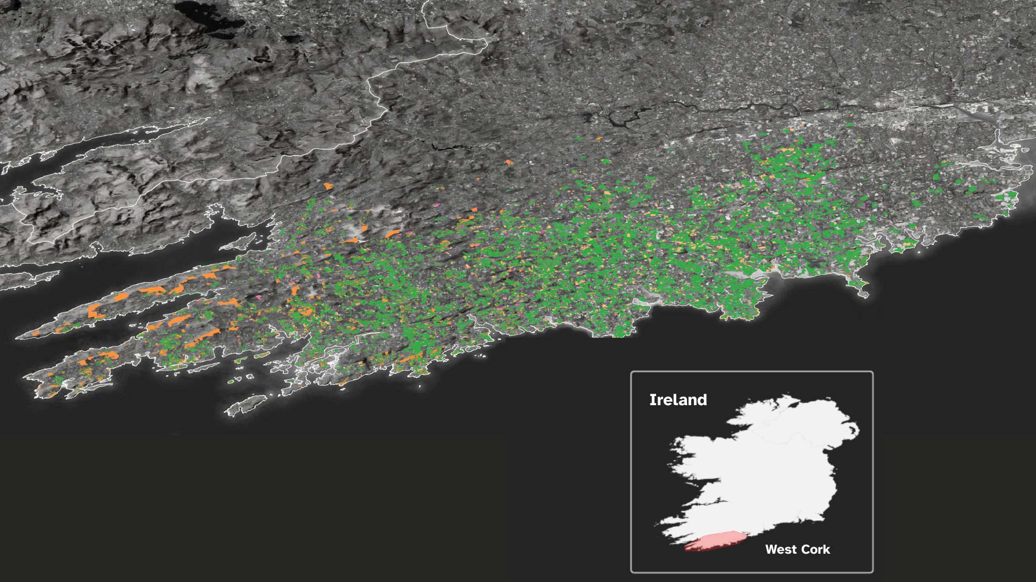
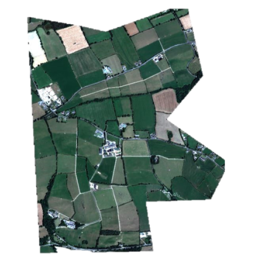
The colours represent Carbery's 980 dairy farms and their habitats mapped in West Cork, Ireland
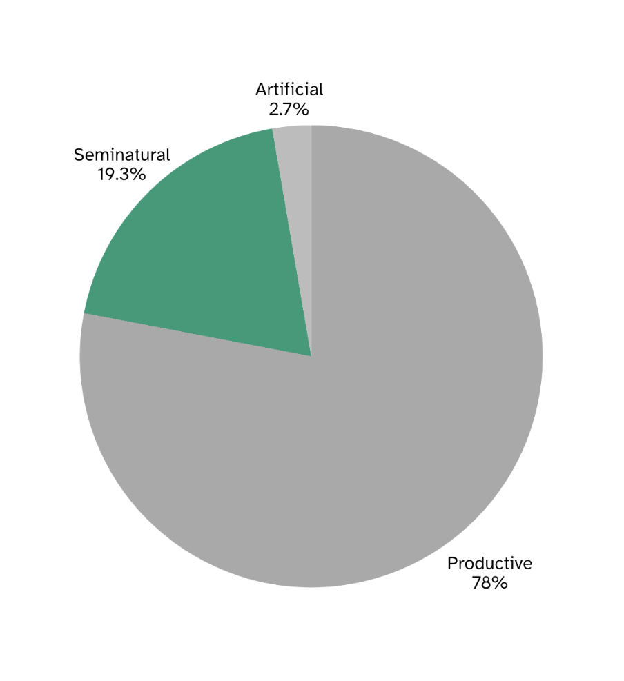
The share of Carbery's land dedicated to nature, production, and built area.
Nearly A Fifth Is Space For Nature
Nature-rich habitat covers far more of the landscape than you would expect in productive dairy country. Clear proof that milk and nature can thrive side by side.
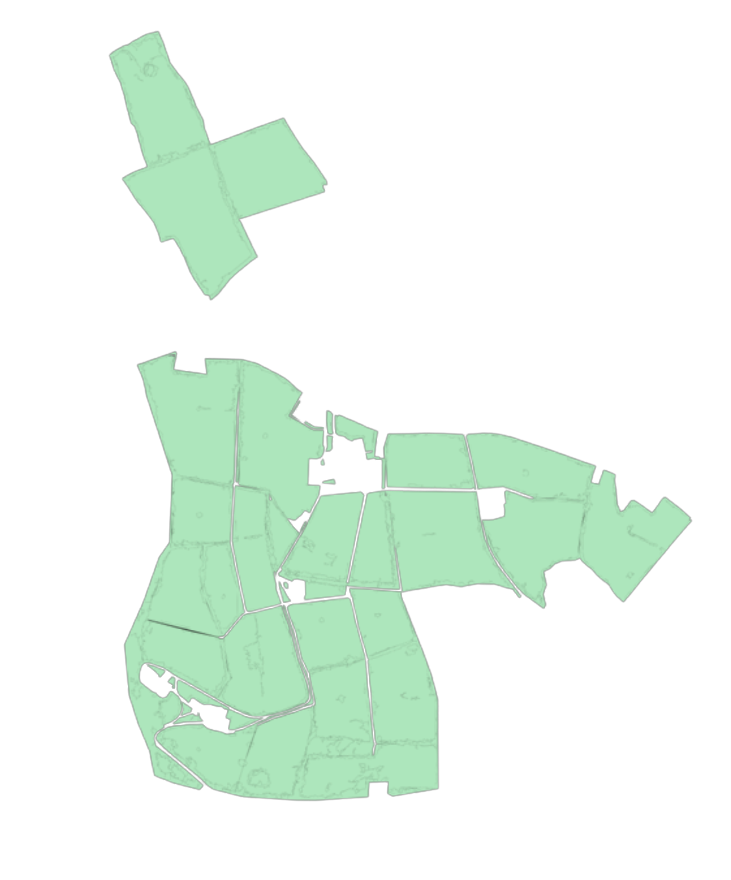
A Living Network Across The Land
Hedgerows, woodland, scrub and semi-natural grassland weave through the farms. The living network that keeps the landscape resilient and gives wildlife room to move.
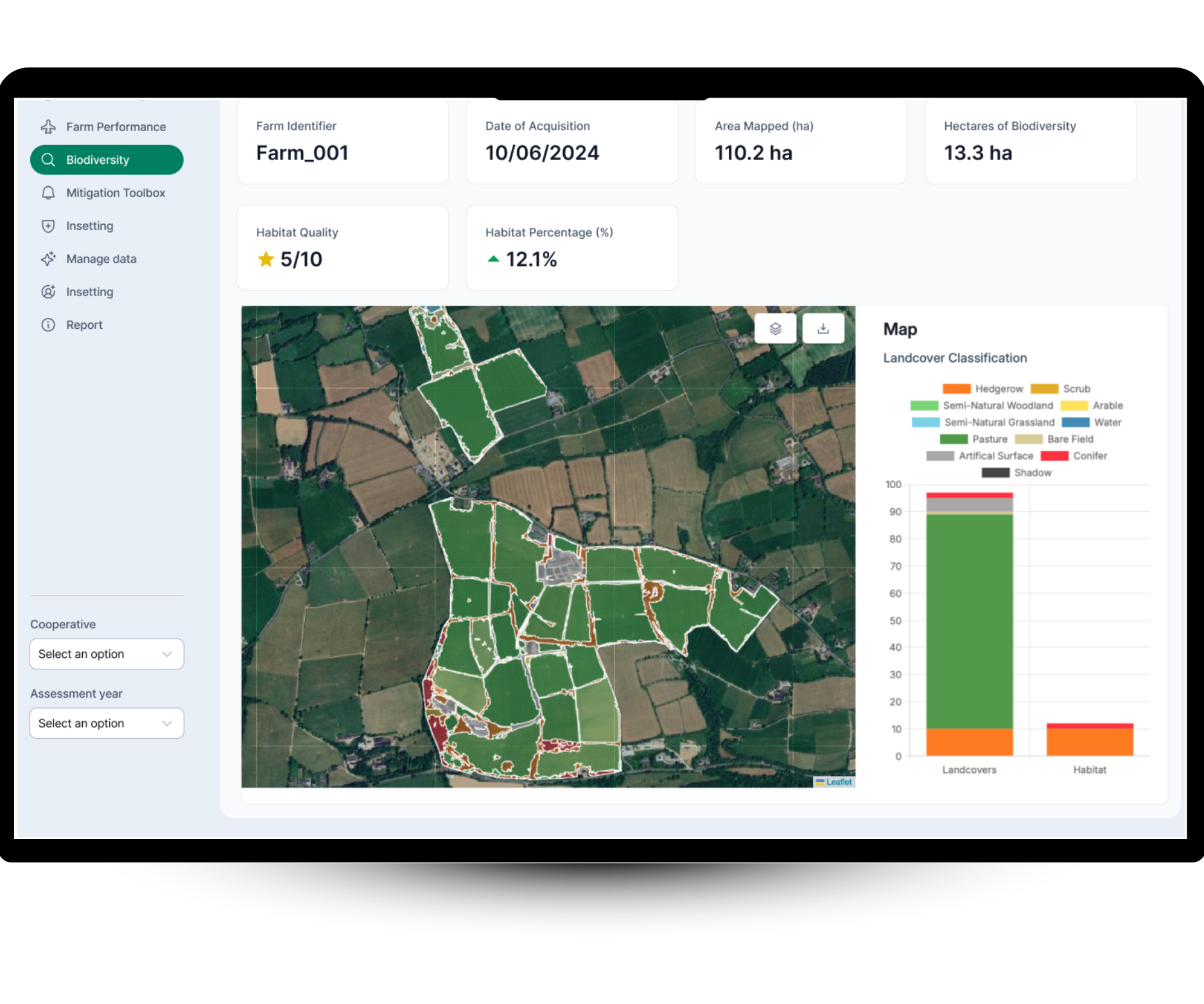
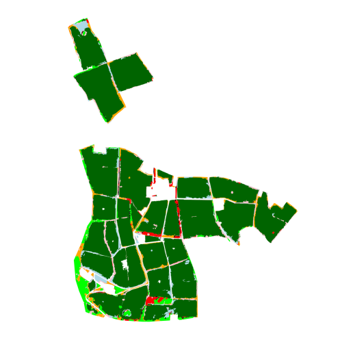
The habitat classifications of one of Carbery's farms
Combining Dairy Production and Nature
Pablo Modernel is Program Manager, Farm Nature at Friesland Campina, helping farmers turn biodiversity research into practice at scale.
“Adding herbage species in the grassland gives us milk from one side and a benefit for insects on the other.”
Turn Every Farm's Land Into
A Biodiversity Score
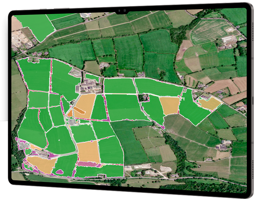
Just tell us where to map. We match your farm boundaries using 50cm satellite imagery to extract parcels. This lets us identify key features like fields, forests, hedgerows, water bodies, and more, in minutes.
Just tell us where to map
Send us your farm list, your coordinates, or your cooperative's supplier database. We take it from there.
We extract your farm boundaries
From 50cm satellite imagery, we extract every parcel, field, woodland, hedgerow, and water body. In minutes, not weeks.
We classify every habitat
AI trained on 39,000+ real-world examples groups satellite pixels into shapes, fields, tree lines, water bodies, and classifies each one as a specific habitat type.
A nature dataset you can act on
The data lands in your dashboard as a Space for Nature score per farm. Pay the farmers protecting nature today. Track who improves tomorrow. Build a supply chain that rewards what's already there.