-
Natura 2000
Natura 2000 Overlap
& Protected Species
Navigate Europe's largest network of protected areas with confidence. Understand biodiversity risks, ensure regulatory compliance, and safeguard natural heritage across your agri-food supply chain.
Understanding Natura 2000
Europe’s cornerstone nature conservation policy is designed to protect the continent’s most valuable and threatened species and habitats.
Key Quality Factors
-
Comprehensive Coverage
Spanning 18% of EU land mass and 7% of maritime areas, Natura 2000 represents the world's largest coordinated network of protected areas.
-
Legal Foundation
Built on two key EU directives: the Birds Directive (1979) and the Habitats Directive (1992), providing robust legal protection.
-
Established Framework
Over 30 years of conservation success, with continuous expansion and refinement to address emerging biodiversity challenges.
Habitat Types
Protected Species
Habitat Types
Protected Species
Types of Protected Areas
Natura 2000 operates through two distinct but complementary designation types, each targeting specific conservation objectives.
Special Protection Areas (SPAs)
Dedicated to conserving rare, threatened, and migratory bird species across Europe’s diverse ecosystems.
Focus: 181 bird species listed in Annex I
Priority: Migratory species & wetland protection
Connection: Ramsar Convention compliance

Special Areas of Conservation (SACs)
Protecting 220 priority habitat types and approximately 1,000 species listed under the Habitats Directive.
Scope: 220 habitat types, 1,000+ species
Goal: Favourable conservation status
Process: Site of Community Importance designation

Special Protection Areas (SPAs)
Dedicated to conserving rare, threatened, and migratory bird species across Europe’s diverse ecosystems.
Focus: 181 bird species listed in Annex I
Priority: Migratory species & wetland protection
Connection: Ramsar Convention compliance
- SPAs ensure critical breeding, feeding, and roosting sites remain protected for Europe’s most vulnerable bird populations.
Special Areas of Conservation (SACs)
Protecting 220 priority habitat types and approximately 1,000 species listed under the Habitats Directive.
Scope: 220 habitat types, 1,000+ species
Goal: Favourable conservation status
Process: Site of Community Importance designation
- SACs maintain and restore Europe’s most threatened ecosystems, from ancient forests to alpine meadows.
Shared Conservation Objective
Both SPA and SAC designations work toward the same fundamental goal: maintaining or restoring habitats and species to favourable conservation status throughout the European Union, ensuring long-term ecological resilience.
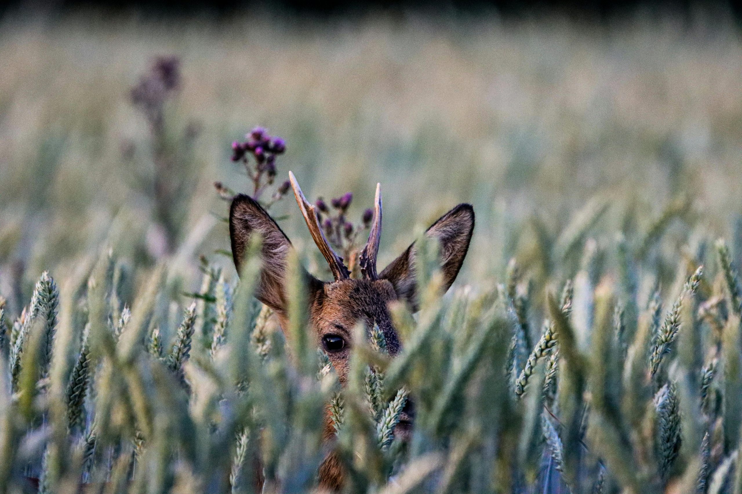
Why Do Protected Species Matter?
Understanding the urgent need for species protection in the face of accelerating biodiversity loss across Europe and globally.
- Critical Statistics
Species at extinction risk: 25%
Natural ecosystems declined: 47%
Wild mammal biomass lost: 82%
Decline since 1970: 69%
- Primary Drivers
Land Use Change (30%)
Direct exploitations (20%)
Climate change (13%)
Pollution (13%)
Invasion species (13%)
- Global Context
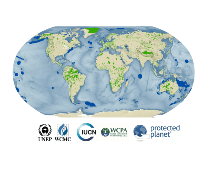
The UNEP/IUCN World Database on Protected Areas tracks over 380,000 protected sites worldwide, providing comprehensive data on marine and terrestrial conservation areas.
- Regulatory Alignment
CSRD ESRS 4
Biodiversity and Ecosystems reporting requirements for red-listed species.
TNFD C5
Species Extinction Risk assessment and disclosure frameworks.
- Critical Statistics
Species at extinction risk
25%
Natural ecosystems declined
47%
Wild mammal biomass lost
82%
Decline since 1970
69%
- Primary Drivers
-
Land Use Change (30%)
-
Direct exploitation (20%)
-
Climate change (13%)
-
Pollution (13%)
-
Invasive species (13%)
- Global Context
The UNEP/IUCN World Database on Protected Areas tracks over 380,000 protected sites worldwide, providing comprehensive data on marine and terrestrial conservation areas.
- Regulatory Alignment
CSRD ESRS 4
Biodiversity and Ecosystems reporting requirements for red-listed species.
TNFD C5
Species Extinction Risk assessment and disclosure frameworks.
- Protected species data enables compliance with emerging sustainability reporting standards while supporting conservation objectives.
From Identification to Action
Understanding Natura 2000 exposure is just the beginning. Transform biodiversity insights into strategic risk management and conservation action.
Risk Mitigation
Identify and address biodiversity risks before they impact operations or reputation
Compliance
Align supply chains with EU biodiversity law and emerging reporting requirements
Strategic Planning
Guide land-use decisions and sourcing strategies with biodiversity intelligence
Performance
Communicate biodiversity performance and conservation impact to stakeholders
Beyond Compliance
Natura 2000 exposure assessment enables proactive biodiversity stewardship that goes beyond regulatory requirements to create genuine conservation impact.
-
Safeguard Natural Heritage
Protect Europe's most valuable ecosystems for future generations
-
Enhance Supply Chain Resilience
Build sustainable sourcing networks that support long-term business continuity
-
Demonstrate Leadership
Position your organization as a biodiversity conservation leader in the agri-food sector
Integrated Conservation
Successful biodiversity management integrates protected area considerations into every aspect of agricultural supply chain planning and operations.
How ODOS Assesses Natura 2000 Exposure
You Provide The Location, We Deliver The Data.
Advanced satellite imagery and comprehensive global datasets transform complex biodiversity information into actionable supply chain intelligence.
-
Satellite Intelligence
High-resolution satellite imagery provides precise geographic boundaries and up to date land use monitoring across global supply chains.
-
Comprehensive Datasets
Integration of Natura 2000 network data with the global WDPA database covering 380,000+ protected sites worldwide.
-
Precise Mapping
Accurate identification of protected areas and red-listed species within specific geographic coordinates of supply chain sites.
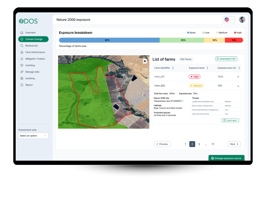
Supply Chain KPIs
- Protected area overlap %
- Average distance km
- Red-listed species
- Habitat types
Farm-Level Detail
- Site identification codes
- Protected habitats present
- Threatened species list
- Priority thread assessment
- Mitigation recommendations
Actionable Outputs
- Risk Assessment Report
- Species Impact Analysis
- Compliance Documentation
- Mitigation Guidelines
Frequently Asked Questions
Common questions about measuring Natura 2000 in agricultural supply chains.
Special Protection Areas (SPAs) focus specifically on bird conservation, protecting 181 rare and migratory bird species listed in the Birds Directive, with particular emphasis on wetland habitats. Special Areas of Conservation (SACs) have a broader scope, protecting 220 habitat types and approximately 1,000 species listed in the Habitats Directive, including mammals, plants, and other wildlife. Both work toward achieving “favourable conservation status” but target different aspects of biodiversity.
Natura 2000 is specifically the EU’s coordinated network of protected areas, covering 18% of EU land and 7% of maritime areas. Global protected areas, tracked through the UNEP/IUCN World Database on Protected Areas (WDPA), include over 380,000 sites worldwide with varying protection levels and management approaches. ODOS integrates both datasets to provide comprehensive biodiversity risk assessment for global supply chains, ensuring coverage both within and outside the EU.
ODOS uses satellite imagery and geographic coordinates to precisely map supply chain locations against protected area boundaries. The assessment provides specific metrics including percentage of farms overlapping with protected areas, average distance to protected sites, and detailed farm-level information about nearby conservation areas. This enables businesses to understand their biodiversity exposure and take appropriate risk management actions.
Red-listed species are those classified as threatened with extinction according to scientific assessments by organizations like the IUCN. They represent biodiversity at highest risk and are often the focus of conservation efforts within protected areas. For businesses, red-listed species presence indicates heightened biodiversity risk and potential regulatory scrutiny. Understanding which red-listed species are present in your supply chain helps prioritize conservation actions and demonstrates environmental stewardship to stakeholders.
The Corporate Sustainability Reporting Directive (CSRD) ESRS 4 requires reporting on biodiversity impacts, including red-listed species exposure. The Task Force on Nature-related Financial Disclosures (TNFD) C5 framework focuses on species extinction risk assessment. ODOS protected area and species data directly supports compliance with both frameworks by providing the biodiversity metrics and documentation required for regulatory reporting, while also enabling proactive risk management.
ODOS combines multiple satellite systems with resolutions from 0.5m to 10m, providing high accuracy for habitat mapping and protected area boundary identification. The technology has been validated through ground-truthing with farmers and sustainability advisors, showing strong correlation with field observations. While satellite assessment cannot replace detailed ecological surveys, it provides cost-effective, scalable biodiversity intelligence suitable for supply chain risk assessment and regulatory reporting requirements.
Learn More About Biodiversity
Dive deeper into biodiversity measurement, conservation strategies, and sustainability reporting with our blog posts related to biodiversity.
Boost Sustainability with Biodiversity in Your Supply Chain
Biodiversity in Agriculture: Why It Matters and How to Measure It?
Biodiversity Footprinting in Vineyards: Methods and Benefits
Ready To Act On Natura 2000?
Book a meeting with our biodiversity specialist to explore how Natura 2000 can work for your supply chain.