Monitor Biodiversity, Remotely and Reliably
Map your supply chain's biodiversity with 88% accuracy
Easily measure biodiversity quantity and quality across any location. No site visit needed.
Our remote sensing technology provides accurate, science-based biodiversity footprint assessments using high-resolution satellite data. Just share the location, and we’ll handle the rest.
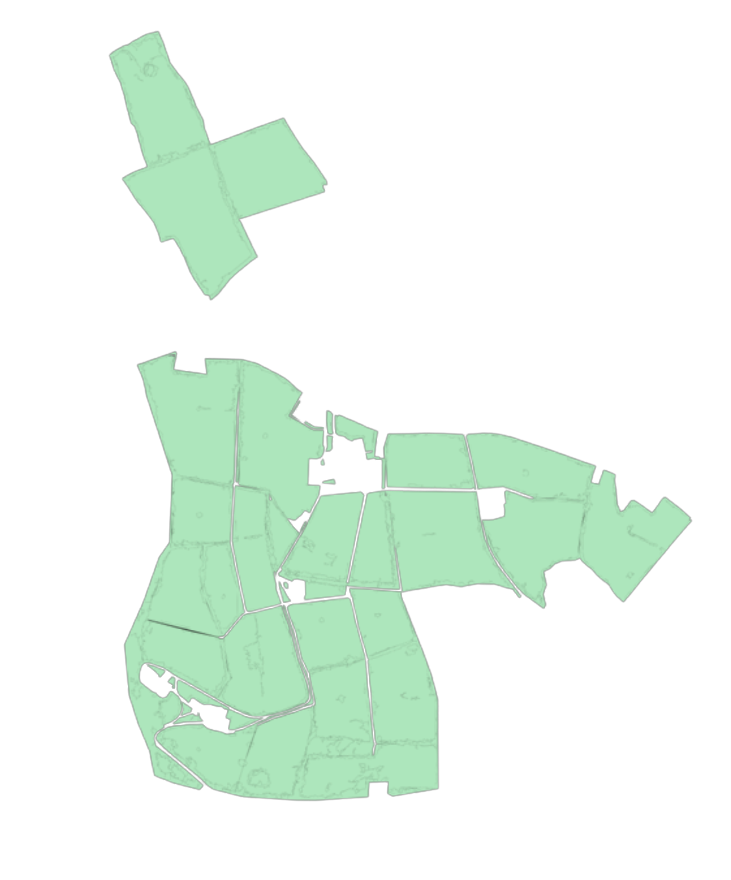
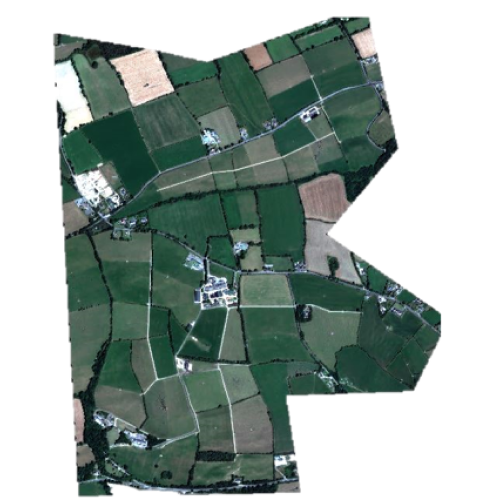
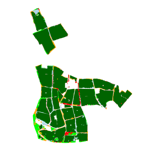
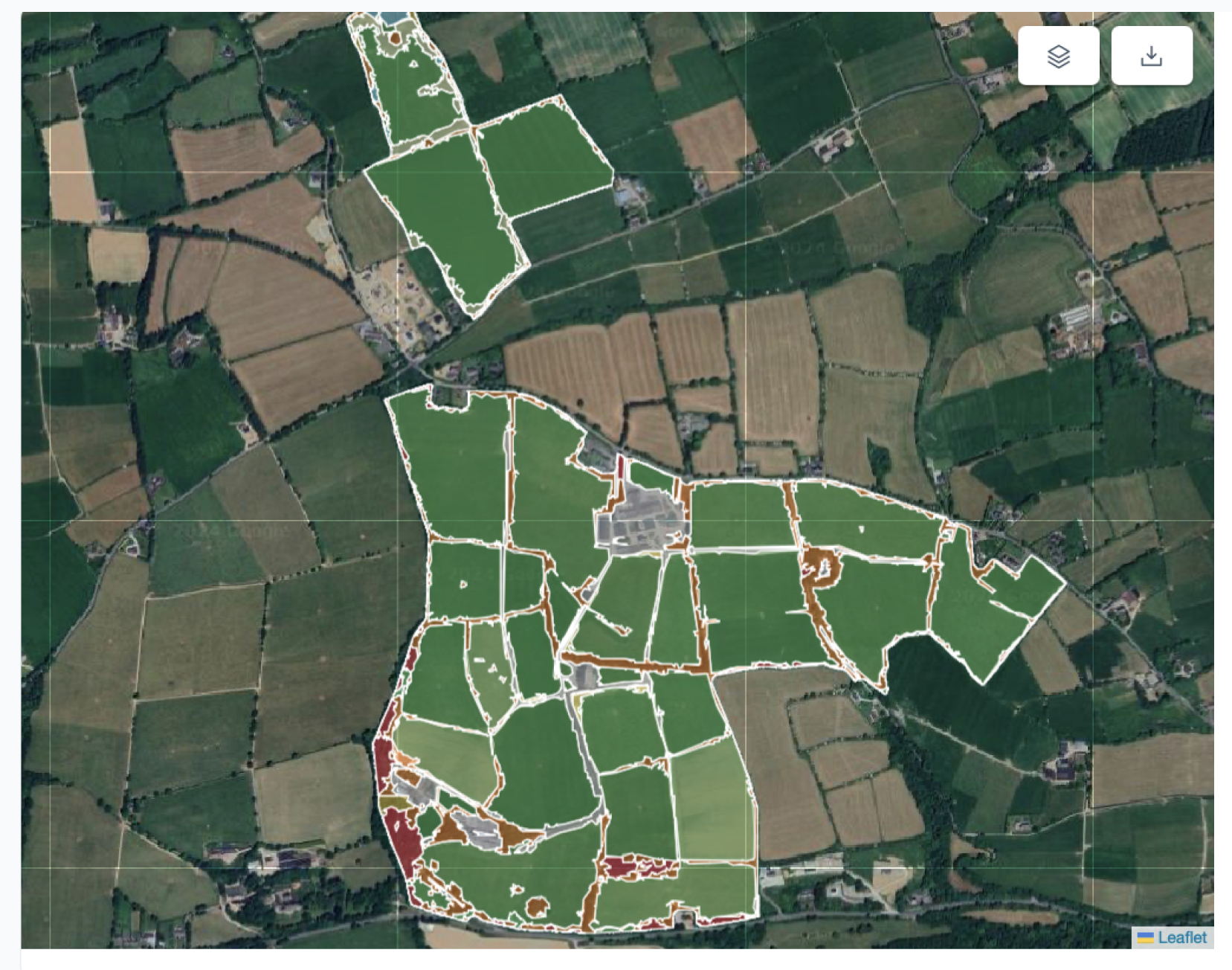
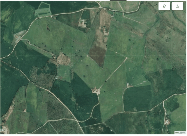
Use the slider to see before/after mapping biodiversity
We Measure Biodiversity in 4 Steps
Tell Us Where To Map
We Get The Best Imagery
AI Models Measure
Access Key Information
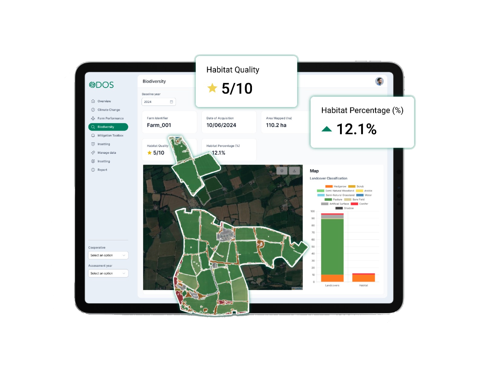
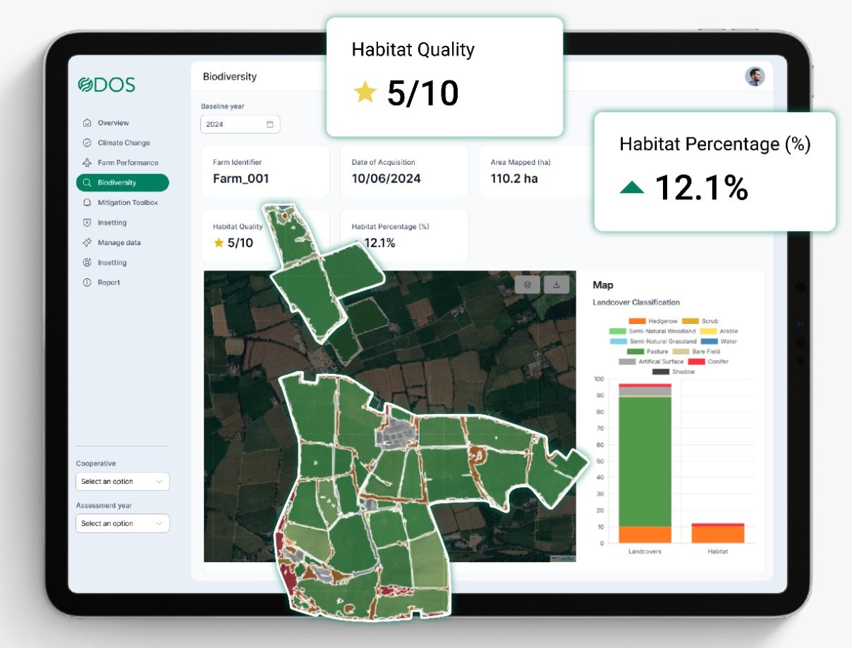
Fully Map Your Biodiversity Quantity and Quality
Quantity Metrics
Measure the total area of key habitats across your land to understand your biodiversity footprint at scale.
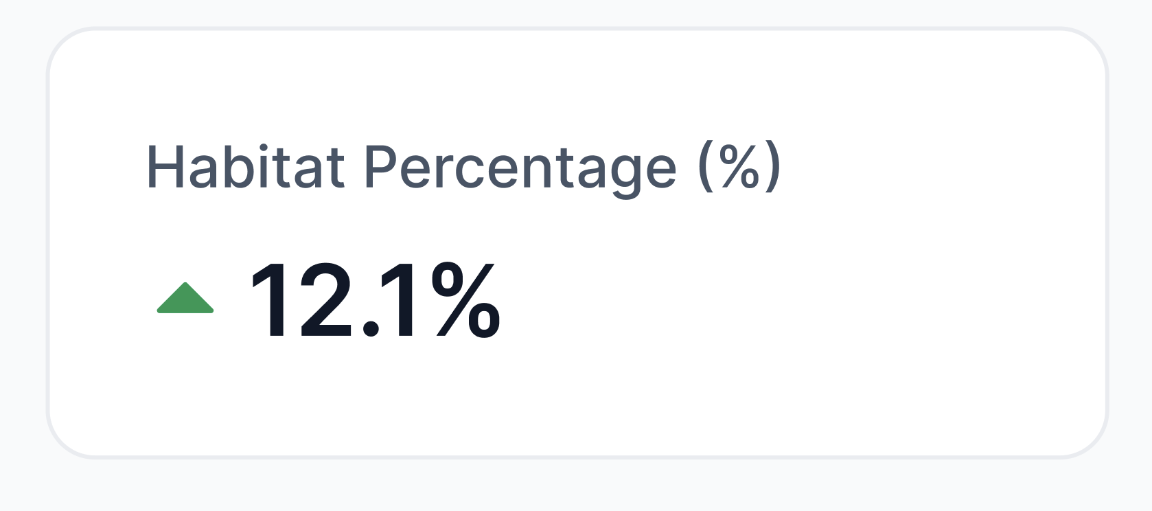
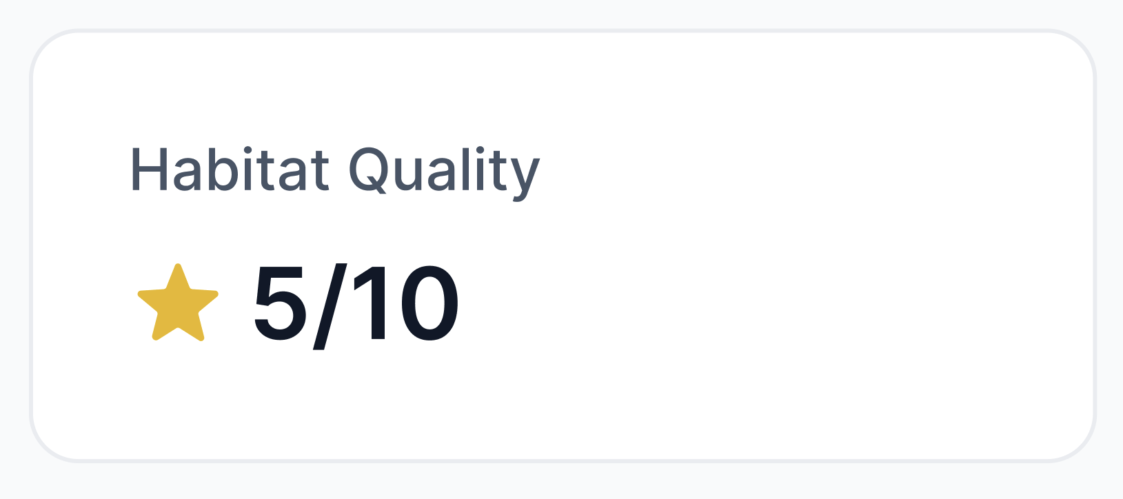
Quality Metrics
Assess habitat condition with precision to track ecosystem health and inform high-impact restoration strategies.
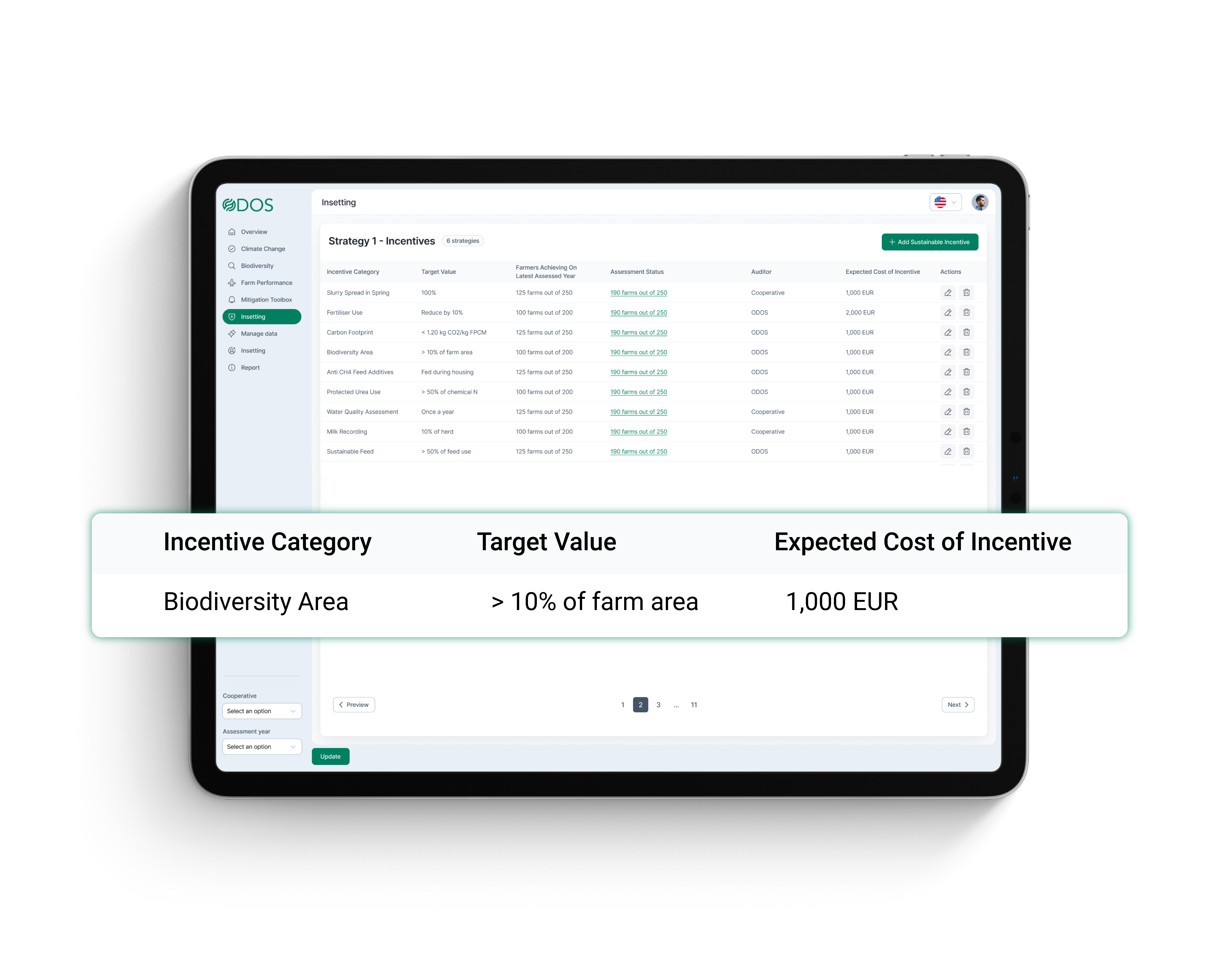
Insetting
Deliver measurable biodiversity gains directly within your supply chain—meeting targets and reducing risk where it matters most.
Just Tell Us Where To Map
Simply share where to map, and we’ll analyze it using high-resolution satellite imagery—no complex data inputs required.
Automatically we will get the best available satellite imagery and our AI models will measure biodiversity quality and quantity at scale.
Quality and Quantity Metrics
Get instant, science-based scores on habitat extent and condition to benchmark biodiversity and track progress over time.
Our assessment aligns with CSRD-recommended quality metrics. All insights are seamlessly integrated into our platform.
Insetting
Identify and implement habitat improvements within your landbase — generating credible, measurable insets for nature-positive reporting.
Project the effect of your mitigation strategies, manage the incentives and track progress across the supply-chain.
Ready to become a Biodiversity champion?
Talk to our Biodiversity experts on how you can start your journey.
Frequently Asked Questions
Biodiversity refers to the variety of life on Earth, including plants, animals, and microorganisms. It is essential for maintaining ecosystem balance and supporting all forms of life. Biodiversity can be measured at different levels—genetic diversity, species diversity, and habitat diversity. Our Biodiversity tool specializes in assessing habitat-level biodiversity, such as forests, grasslands, wetlands, and more.
Biodiversity quantity refers to the total area covered by different types of habitats, such as forests, wetlands, and grasslands. Our Biodiversity tool uses high-resolution satellite imagery to measure the extent of these habitats, providing an accurate assessment of biodiversity at a landscape level.
Biodiversity quality assesses how well a habitat supports ecological functions and species diversity. Our tool evaluates factors such as habitat connectivity, size, and health, assigning a quality score from 1 to 10. Higher scores indicate more resilient and ecologically valuable habitats.
We source our images from very-high-resolution satellite providers and verified external data sources. This ensures that our biodiversity assessments are accurate, up-to-date, and reliable.
Our price depends on the scale of your supply chain, this includes # of farms, size of farms and the image resolution needed. Contact us to get a specific price for your project.
Our tool aligns with the Corporate Sustainability Reporting Directive (CSRD) by providing transparent, traceable biodiversity metrics. It simplifies compliance with sustainability disclosure requirements, helping businesses report on biodiversity impacts and align with European Sustainability Reporting Standards (ESRS).
We use advanced machine learning algorithms to analyze satellite imagery, detecting and classifying different habitat types. Our proprietary Habitat Extent Tool measures the area of various ecosystems, while our Habitat Condition Tool assesses their quality, providing a comprehensive biodiversity assessment.
Our AI-powered system delivers biodiversity assessments within minutes to hours, depending on the size of the area being analyzed. This rapid evaluation enables businesses to track biodiversity changes over time and integrate insights into their sustainability strategies efficiently.