Measure Land Use With Satellite Intelligence
Unlock insights into regenerative agriculture, biodiversity mapping, and climate risk assessment through the real-world case of Familia Torres, a leading European winery.
What's inside the E-book:
-
How Familia Torres achieved 4x the EU biodiversity target
-
Remote detection of regenerative agriculture practices at scale
-
Climate risk scenarios to future-proof vineyard production
-
Remote Sensing Intelligence
Understanding Land Use Change
Discover how satellite technology transforms agricultural sustainability measurement.
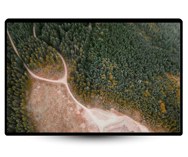
What Is Land Use Change
Land use change refers to the transformation of natural landscapes for human activities like agriculture, urbanization, and infrastructure development. These changes significantly impact biodiversity, carbon storage, and ecosystem services.
-
Natural land replaced by agriculture.
-
Urban growth reshapes rural ecosystems.
-
Infrastructure expansion fragments natural habitats.
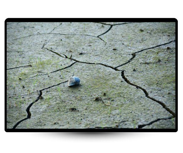
Why It Matters
In agriculture, nature is the backbone of productivity: pollination, soil health, water cycles, and climate resilience all depend on healthy ecosystems. Yet biodiversity has dropped by 70% since 1970, largely due to land use change. Agriculture now covers 40% of global land. By 2030, the EU requires 10% of farmland to be set aside as “Space for Nature.”
-
Biodiversity has dropped by 70% since 1970
-
Nature as backbone of farm productivity
-
EU demands farmland natural zones
How We Measure Land Use Performance
We use satellite imagery to detect changes in land cover, like deforestation, crop expansion, or habitat loss. Our AI models analyze this imagery to map biodiversity, soil cover, and landscape features over time. This gives you accurate, scalable insights, without needing to visit every farm.
-
AI scans satellite image change
-
Track nature loss across farms.
-
Measure impact without field visits.
What's Inside The E-book
-
The Familia Torres Case Study
-
The Familia Torres Case Study
Real-World Land Use Detection
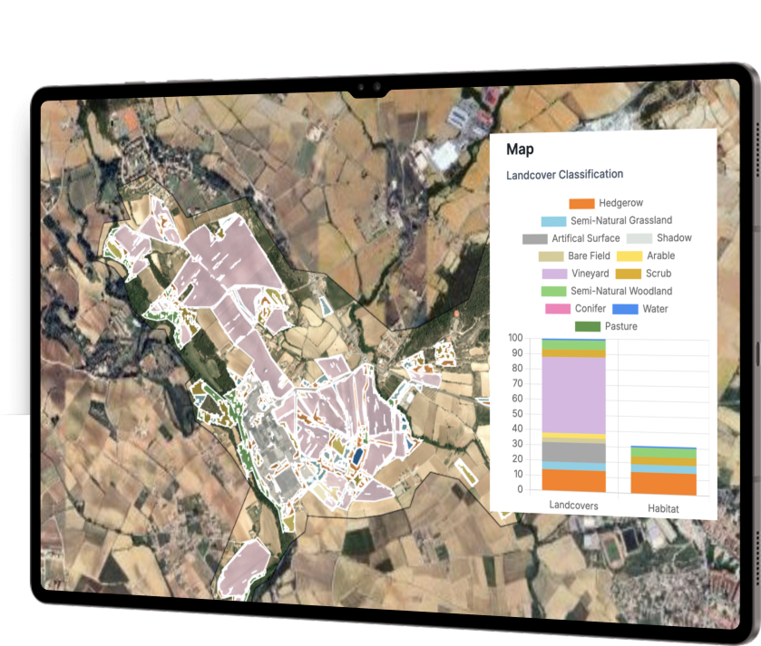
Familia Torres, one of Spain’s most respected and historic wine producers, has long been recognized for its leadership in sustainability. To strengthen this commitment, they partnered with ODOS to map biodiversity, detect regenerative practices, and assess climate risks across their vineyards.
Using very high-resolution imagery and AI-powered mapping, our analysis revealed that their vineyards contain nearly four times the biodiversity required under EU standards, while also demonstrating the measurable impact of regenerative agriculture.
Key Insights
-
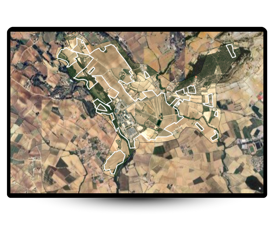
Space For Nature Mapped
We measured biodiversity at two vineyards (152 ha and 129 ha) using very high-resolution satellite imagery (<1m). This showed how much natural habitat surrounds productive land.
-
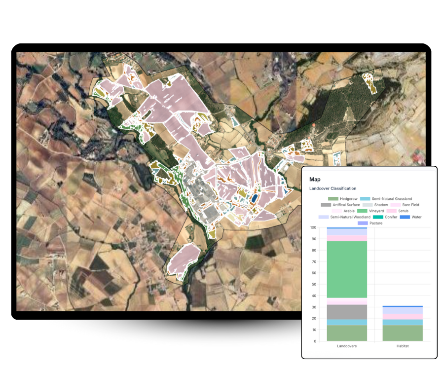
Regenerative Practices Tracked
Our AI-based habitat classification detected interrow vegetation between vines, proving where regenerative agriculture was being applied and how it created species-rich habitat.
-
Climate Resilience Measured
Using climate indices (Huglin, Growing Season Precipitation, BBL mildew risk), we modeled current and future risks, showing how vineyards may be affected by heat, drought, and disease.
Measure Land Use Performance In Your
Supply Chain
Talk to our team about how ODOS Tech can help you track biodiversity, regenerative agriculture, and/or climate risk, anywhere in the world. Join other industry frontrunners proving their impact with data-driven sustainability intelligence.